Scout your next climb in Idaho
Gannett Hills Rick Baugher


From the 8809' summit of Red Mountain the view is south to Thomas Fork Valley. Photo 10/26/01 by Rick Baugher

The Gannett Hills

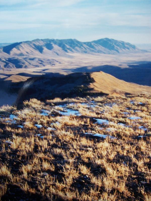
The Gannett Hills straddle the Idaho-Wyoming border NE of Montpelier, Idaho, and SW of Afton, Wyoming. About 15 miles of Great Basin- Columbia Divide pass through these mountains. The handful of small peaks in the range are not particularly easy to reach, and a good portion of the area is roadless. Red Mountain el 8809' in Bear Lake County, Idaho, is the range highpoint.

From the 8809' summit of Red Mountain the view is south to Thomas Fork Valley. The shadow line in the photo closely traces the Idaho-Wyoming stateline. Beyond is the Sublette Range in Wyoming with highpoint Sublette Mountain el 9313'. 10/26/01.


View W to Salt Pass Peak on 3/17/06.. Photo by Rick Baugher.

If you want to visit the Gannett Hills in winter and don't have a snow machine, try starting from Salt River Pass el 7610' on US Highway 89 in Wyoming. Head west on skis or snowshoes through lovely snow blanketed meadows into open stands of aspen and spruce. The unnamed 'Salt Pass Peak' el 8120'+ is a good destination.


Photo courtesy USGS

The Gannett Hills are named for Henry Gannett (1846-1914), an icon of early American mountaineering, who is credited with first ascents of Colorado Fourteeners and peaks in Yellowstone National Park, among others. In 1871 the young Harvard graduate signed on with the Hayden Survey as Astronomer, where he worked in the Idaho-Wyoming field. He became Chief Geographer of the US Geological Survey in 1882. In 1890 he organized the US Board on Geographic Names, and was a founder and president of the National Geographic Society. Henry Gannett has been referred to as "The father of American mapmaking". Photo courtesy USGS.


Report by Rick Baugher

Feb 28, 2009


Photos and information by Rick Baugher

Email me your route descriptions and pictures to rob@climbingidaho.com.


© 2009 ClimbingIdaho.com
Email the webmaster